If you’re bored of lockdown strolls in the local park, try these online hikes to Everest and Patagonia and a jaw-dropping ascent of El Capitan
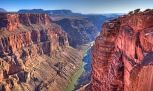
The Grand Canyon, USA
At 277 miles in length, 18 miles across at its widest, and a maximum 1,857 metres deep, this vast Arizona landmark is grand in nature as well as name. Around 40 sedimentary layers are visible in its steep cliffs, with the oldest basement rocks formed around two billion years ago. Hike the canyon’s Bright Angel Trail via a Google Street View Trek. One of the most popular long-distance routes in the national park (9.3 miles), it zigzags up from the Colorado River to the south rim. Like with other entries in the list, wider exploration is on offer with Google Earth view, which lets users zoom in and out and click into points of interest – the peaks of Wontons Throne or Angels Window, for example – for further information. Another VR project, AirPano, has high-definition 360-degree images for a bird’s eye view of the Red Rocks.
Mount Everest, Nepal
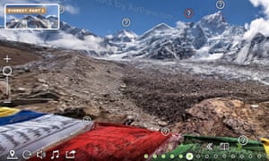
Known in Nepali as Sagarmatha and Tibetan as Chomolungma, the world’s highest peak sits on the border between Nepal and China. Explore Everest’s south base camp in Nepal, at an altitude of 5,380 metres, with interactive 360-degree views of snowy peaks and colourful prayer flags. Via an interactive map, and a 3D rotating viewer, you can gaze at the 8,848-metre summit, plus other Himalayan peaks stretching west into Pakistan and east to Bhutan. Clicking the human-shaped icon on this page highlights all the points around the mountain range that can be explored further at ground level. Views from other peaks, including over the Imja River and mountain villages, are visible in these 360 degree images. There’s also shot of a busier south base camp – it sees about 35,000 visitors a year, after all.
The northern lights
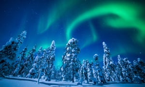
The aurora borealis is a dazzling natural phenomenon caused by Earth’s magnetic field interacting with electrically charged particles from the sun. The lights are visible from countries at high northern latitudes, such as those of Scandinavia, Russia, Iceland, Greenland and Canada. The Norwegian Lights over Lapland project takes travellers on a five-minute journey through a series of 360-degree videos. The virtual trip starts in the Icehotel in Abisko national park, northern Sweden, heads into the wilderness on a reindeer sleigh, passing Lake Torneträsk and an Arctic birch forest on the way to a cosy wooden Sami hut at the base of Mount Noulja. A series of time-lapse videos then show the lights dancing overhead in vibrant streaks and arcs of rippling green. There are 360-degree images with a view from elsewhere in the world, including Iceland, over the Goðafoss waterfall; in Yamal and on the shore of the Barents Sea in Russia; and in several locations around Norway. You could even be lucky enough to witness the lights live via webcam in Manitoba, Canada.
Hang Sơn Đoòng, Vietnam
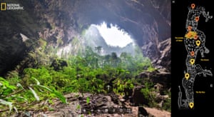
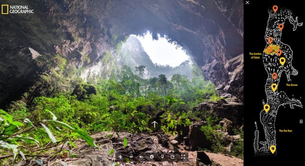
The world’s largest cave, Hang Sơn Đoòng in central Vietnam’s Phong Nha-Ke Bang national park, was explored by scientists for the first time in 2009, after a local man, Ho Khanh, discovered it in 1991, but did not locate it again until many years later. Sơn Đoòng 360 is a project by National Geographic aiming to preserve the cave in digital form before it becomes subject to extensive tourism development. A trek – created from 360-degree images and atmospheric sound effects – heads through light-filled caverns, passing a 70 metre-tall stalagmite called Hand of Dog, and huge sinkhole jungles. Keep an eye out for members of the expedition crew, and take advantage of the high- definition images to zoom into details of the cave’s geology, flora – and fauna, too, if you look hard enough.
Yosemite national park, USA
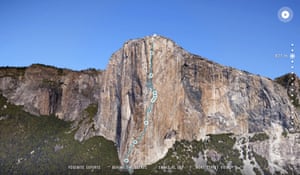
Yosemite, in California’s Sierra Nevada mountains, is a diverse and spectacular natural landscape. It’s home to more than 400 species of animals, including around 500 American black bears, rare snowshoe hares and endangered mastiff bats. Granite monoliths tower over meadows, rivers and forests, including one the park’s most notable sights, El Capitan, standing over 900 metres tall with a near vertical cliff face. US climber Lynn Hill was the first person to free climb (without aid equipment) the challenging Nose route in 1993. Scale the mountain with Hill and her team, learning more about skills, techniques and equipment as you ascend to dizzying heights. The climbers jam their hands into “flakes” of rock and swing across the face to reach vertical cracks, stopping on a ledge, El Cap Tower, for the night. Explore the national park further with these 360-degree images, complete with sound effects, including sound Ahwahnee Meadow and Nevada Fall.
Zhāngjiājiè national forest park, China
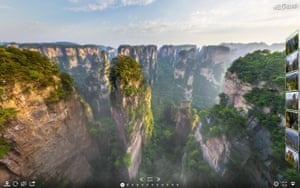
The quartz-sandstone pillars of Zhāngjiājiè – pronounced jaang-jyaa-jie – were the inspiration for the floating peaks of the Hallelujah Mountains in James Cameron’s Avatar film. Their unique shape is caused by physical erosion from water, ice and the roots of trees and foliage. Take flight around these towering natural columns – some stretching up over 1,000 metres – in an interactive video tour exploring the site, and zoom into high definition 360 degree shots from the sky. The park is also home to an ancient temple from 870AD, the cliffside Bailong glass elevator, and the world’s highest and longest glass bridge, strung between mountains 300 metres up, and a busy tourist spot – though seen in these 360-degree images with fewer crowds.
Giants Causeway, Northern Ireland
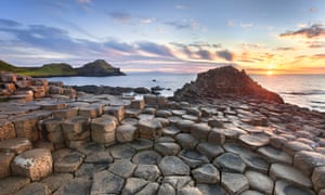
This fantastical section of County Antrim’s Atlantic coastline is made up of more than 40,000 interlocking, geometric (mostly hexagonal) basalt columns. Legend has it that the unusual rock formations are the remains of a stepping-stone causeway path to Scotland, built by giants. Scientists believe they were in fact formed by lava flowing into the sea, as molten basalt erupted through chalk beds 50 to 60 million years ago. The National Trust has created a series of virtual tours, with views from Aird Snout headland and by the water’s edge in the bay of Port Noffer at different times of day. There are also sweeping views from above to explore elsewhere, including the Carrick A Rede trail and rope bridge.
Perito Moreno glacier, Argentinian Patagonia
Despite the climate crisis causing many of the Earth’s glaciers to shrink, the defiant Perito Moreno remains largely undiminished; if anything, scientists say it’s growing. Covering 97 square miles of Los Glaciares national park, it is fed by the melting waters of the south Patagonian ice fields in the Andes. A set of interactive images on 360cities, give an impression of the scale (use the white arrows to click between views), as well as the variations of blue – the less oxygen in the ice, the bluer it gets. An immersive video tour of the wilderness beyond the glacier, created by the Guardian in 2018 (above), takes viewers around the varied landscape of the protected Parque Patagonia, passing turquoise rapids, a rainbow and a pack of guanacos roaming the plains.
Ambrym volcano, Vanuatu
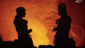
This virtual tour ventures down into one of the world’s most active volcanoes, just a few metres from a churning 1,200C lava lake. It follows adventurers Ulla Lohmann and Sebastian Hoffmann, a couple who make documentary films, along with volcanologist Thomas Boyer, who descend together to the third terrace of Benbow, one of the main vents of the Ambrym volcano, on the South Pacific island nation of Vanuatu.. The short interactive film joins the team as they prepare for the expedition, travel to base camp, up to the rim beyond the jungle, into the ash plain, and abseil down into the crevice, sitting just 60m away from the lava. The longer hair-raising 25-minute documentary, Spitting Distance – The Descent Into a Raging Volcano, is also available online.
Namib desert dunes, Namibia

The swirling sculptural patterns the Namib desert’s sand dunes stretch for 31,000 square miles across the Namib-Naukluft national park in southern Africa. Some of the largest can be found in the Sossusvlei area, home to mountainous swathes of pink-orange sand, including the 388m-high Dune 7, which sits opposite Big Daddy at 325m, and Big Mamma, 198m. There are several interactive 360-degree images offering views from the giant dune ridges. The tour also includes the iconic Deadvlei, a salty clay pan backdrop to blackened, dead acacia trees; mist approaching from the sea of the Skeleton Coast; and a starlit scene showing the Milky Way.
Source: The Guardian

Leave a Reply